Edale Circular via Kinder Scout and Mam Tor walk
Rugged moorlands and dramatically sculpted gritstone outcrops, the lush Vale of Edale and grand views into the Hope Valley from Mam Tor
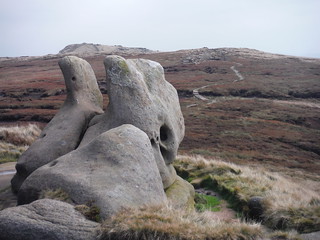
Upper Tor, Nether Tor, Golden Clough
SWC Walk 303 - Edale Circular (via Kinder Scout and Mam Tor)
Aug-17 • thomasgrabow on Flickr
swcwalks swcwalk303 banner 26467366019

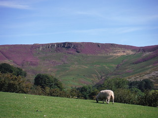
Vale of Edale, Mam Tor and Lord's Seat
SWC Walk 303 - Edale Circular (via Kinder Scout and Mam Tor)
Aug-17 • thomasgrabow on Flickr
swcwalks swcwalk303 walkicon 24371822518

Vale of Edale, from Top of Jacob's Ladder
SWC Walk 303 - Edale Circular (via Kinder Scout and Mam Tor)
Aug-17 • thomasgrabow on Flickr
swcwalks swcwalk303 walkicon 38211254892
![Ringing Roger from Grindsbrook Clough SWC Walk 303 - Edale Circular (via Kinder Scout and Mam Tor) [Grindsbrook Clough Descent Alternative]](https://live.staticflickr.com/4454/38188282526_67962d3f9f_n.jpg)
Ringing Roger from Grindsbrook Clough
SWC Walk 303 - Edale Circular (via Kinder Scout and Mam Tor) [Grindsbrook Clough Descent Alternative]
Aug-17 • thomasgrabow on Flickr
swcwalks swcwalk303 walkicon 38188282526
Henry Moore was here, Kinder Scout
SWC Walk 303 - Edale Circular (via Kinder Scout and Mam Tor)
Sep-17 • thomasgrabow on Flickr
swcwalks swcwalk303 walkicon 38212542892

Paraglider and Winnats Pass
SWC Walk 303 - Edale Circular (via Kinder Scout and Mam Tor)
Sep-17 • thomasgrabow on Flickr
swcwalks swcwalk303 walkicon 37533517524

Plaque at Start of The Pennine Way, Grindsbrook Booth/Edale
SWC Walk 303 - Edale Circular (via Kinder Scout and Mam Tor)
Aug-17 • thomasgrabow on Flickr
swcwalks swcwalk303 38243670521
| Length | 20.6 km (12.8 mi), with 897m ascent/descent. For a shorter or longer walk see below Walk Options. |
|---|---|
| Toughness | 7 out of 10, with 5 ¾ hours walking time. For the whole outing, including trains, sights and meals, allow at least 12 hours. |
| Walk Notes |
A walk of many contrasts in the Dark Peak area of the Peak District, associated with rugged moorlands and dramatically sculpted gritstone outcrops (or ‘edges’), which also routes through the lush Vale of Edale, while in the afternoon affording grand views into the Hope Valley (including the notable dry gorge of Winnats Pass) from the Great Ridge, which separates the Dark Peak (sandstones) from the White Peak (limestones).
An extension to Kinder Downfall, the highest waterfall in the Peak District, either as an out-and-back or combined with a crossing of the Kinder Plateau upland peat bog (only for confident navigators), as well as some shortcuts before and after lunch, are described. |
| Walk Options |
An out-and-back Extension to Kinder Downfall, the highest waterfall in the Peak District: add 5.4 km/3.4 mi and 165m ascent/descent.
|
| Maps |
OS Explorer: OL1 (The Peak District – Dark Peak Area)
|
| Travel |
Edale Station, map reference SK 122 853, is 236 km north west of Charing Cross and 245m above sea level, and in Derbyshire. It is on the Hope Valley Line from Manchester to Sheffield, with a journey time from 33 mins from Sheffield. Sheffield Station is the terminus of the Midland Main Line from London St. Pancras, with up to two trains per hour (journey time from 118 mins Mon-Sat, longer on Sundays). Saturday Walkers’ Club: Take a train no later than 9.00 hours. |
| Lunch |
The Old Nag’s Head Grindsbrook Booth, Edale, Hope Valley, Derbyshire, S33 7ZD (01433 670 291). The Old Nag’s Head is located 14.4 km (9.0 mi) into the walk. Situated at the start of the Pennine Way, it dates back to 1577. Overlooked to the North by Kinder Scout, made famous by the Mass Trespass of 1932, and residing in one of the World’s most visited national parks – the Peak District – The Old Nag’s Head is listed as one of the 100 greatest pubs of England.
|
| Tea |
The Old Nag’s Head & The Rambler Inn As above.
|
| Profile | |
|---|---|
| Help Us! |
After the walk, please leave a comment, it really helps. Thanks! You can also upload photos to the SWC Group on Flickr (upload your photos) and videos to Youtube. This walk's tags are: |
| By Train |
Out (not a train station) Back (not a train station) |
| By Car |
Start S33 7ZN Map Directions |
| Amazon | |
| Help |
National Rail: 03457 48 49 50 • Traveline (bus times): 0871 200 22 33 (12p/min) • TFL (London) : 0343 222 1234 |
| Version |
Apr-24 Thomas G |
| Copyright | © Saturday Walkers Club. All Rights Reserved. No commercial use. No copying. No derivatives. Free with attribution for one time non-commercial use only. www.walkingclub.org.uk/site/license.shtml |

Walk Directions
Full directions for this walk are in a PDF file (link above) which you can print, or download on to a Kindle, tablet, or smartphone.
This is just the introduction. This walk's detailed directions are in a PDF available from wwww.walkingclub.org.uk