Ockley to Warnham Walk
A quiet corner of Surrey - woods, gentle hills and a lovely lunchtime pub

Walking down the lane
Ockley to Warnham walk
Mar-16 • Saturdaywalker on Flickr
book1 walkicon swcwalks walk47 26101789675

Ockley bluebells
Ockley to Warnham walk
Apr-17 • Saturdaywalker on Flickr
swcwalks book1 walk47 walkicon 34271512042

Snowdrops wild in the woods
Ockley to Wareham walk
Feb-23 • Saturdaywalker on Flickr
swcwalks book1 walk47 walkicon 52685409584
All the world's a path
And all the people in it merely walkers Whether tis nobler to duck the fence, Or shuffle o'er this lowly stile, Aye there's the pub..... Ockley to Warnham
book1 swcwalks walk47 2063561332

Woods & rural delights
| Length | 16.5km (10.3 miles), 5 hours. For the whole outing, including trains, sights and meals, allow 8 hours 40 minutes. |
|---|---|
| Toughness | 3 out of 10. |
| OS Maps | Explorers OL34 (was 134) & 146 or Landranger 187. Ockley, map reference TQ 165 404, is in Surrey, 9km north-west of Horsham and 7km north of Warnham, which is in West Sussex. |
| Features |
This is a beautiful walk through an unspoilt countryside of fields, woods and gentle hills, with a choice of two homely country pubs for lunch. The peace and idyll is only spoilt on those days when the landing and take off flight paths for Gatwick airport are directly above the walk route. In this sleepy corner on the Surrey-Sussex border it seems as if nothing exceptional has happened through the ages. You go through no bustling towns, pass no grand country houses and there are no particularly interesting historical events to relate. Just mile after mile of oak woods and rural delights. The highlights of the walk are St John the Baptist church, in a sublime location, hidden in a woodland valley, and the 2 lunch pubs. Note that there is no Sunday service or evening service on this line (see last train times below), and it is 1.3km to the station from the village pub in Warnham. Check the time of the last train! There is a longer option, finishing in Horsham, which has trains till late. In winter and after periods of heavy rain sections of the walk through woodland can be very muddy, so wearing sound walking boots is a must at these times. |
| Walk Options |
If detouring to the Punchbowl pub, the diversion and onward route reduces the length of the walk by just under 1 mile, however, you miss the St John the Baptist church. If picnicking by the porch to the St John the Bapiste church in its remote, delightful setting in the woods, you can by-pass the loop to the lunch pub in Walliswood by taking a more direct route from the church to the road which connnects you to Rosehill Cottage where you rejoin the main walk. This reduces the length of the main walk by 1.2 kms. The Hannah Peschar Sculpture Garden is off route, north of St John the Baptist church, and the detour there and back adds 1.78 km to the walk length. To do this attraction justice you would need to spend some 2 hours there - so if finishing your walk at Warnham, check the time of the last train! You could call a taxi from either of the lunch pubs to Warnham or Horsham Station. You can extend the walk to Horsham, giving an overall walk of 20 km (12.5 miles). The more scenic route to Horsham, through a large deer farm on the way, bypasses Warnham. A second option, starting further on in Warnham, is also quite pleasant, and comes into play if you encounter problems with trains out of Warnham, with its last trains leaving early in the evening. This extension also works for walkers who arrive at walk-end in Warnham but fancy walking a little further. It now has a safe crossing of the very busy A24 road. |
| History |
The 13th century Parish Church of St John the Baptist (Friends of, Photos) in Okewood has wall paintings and an unusual arrangement of roof beams. The Hannah Peschar Sculpture Garden, near St John the Baptist church, is a world class woodland garden with (changing) sculptures. Pre-booking only, Apr-Oct, Thursday to Saturday from 11 am to 6 pm, Sunday from 12 noon until 5 pm, Bank Holiday Mondays from 11 am until 6 pm; Groups of 4 or more adults on Tuesday and Wednesday, 11 am until 6 pm - last entry on all days 1 hour before closing. Entry charge (from April 2025): £15 (half price with Gardeners World annual scheme). Spring is better for flowers, but still impressive in late summer. Warnham's best known son is the romantic poet Percy Bysshe Shelley who was born at Field Place, just south of the village, in 1792. Expelled from Oxford for his pamphlet The Necessity of Atheism and eloping with 16 year-old Harriet Westbrook, he was forbidden by his father Sir Timothy Shelley ever to visit the family seat in case he might corrupt his sisters. He had an eventfull life before dying in a sailing accident at the age of 29. He did not achieve recognition for his poetry until after his death. |
| Travel |
Take the train nearest to 9.30am from Victoria Station to Ockley. Journey time 1 hour 10 minutes. No service on Saturday evenings, Sundays, and some Bank Holiday Mondays Direct trains back from Warnham are hourly but you can also catch one of the hourly trains in the other direction and change at Horsham; the journey time for both routes is about 1 hour 15 minutes. Note that the last direct train back is currently around 9:30pm (weekdays) and 5:30pm (Saturdays), with the last train via Horsham about 30 minutes later. Buy a day return to Warnham, which usually works even if returning via Horsham. Horsham has regular trains (via Gatwick Airport) until late. Buy a return to Horsham if finishing here. Southern's current timetable (Winter 2025) is user friendly to mid-week and Saturday walkers, with departures from Victoria at 9-41am, Monday to Saturday. However, whilst this works for senior railcard holders on weekdays, the downside is this train is now an all-stopping service - so bring along a book to read. |
| Lunch |
The suggested lunch place is the Scarlett Arms pub (tel. 01306-627243) in Walliswood, some 7.2 km into the walk. This is a walker-friendly, old-fashioned, homely pub with an inglenook fireplace for cold winter days and a garden for sitting outside in the summer. The current (2025) menu consists of pub favorites plus daily specials and lighter fare such as sandwiches. Lunch is served between 12 noon and 2-45 pm Wednesday to Saturday (not open lunchtime on Monday and Tuesdays), and 12 noon and 3-45 pm on Sundays. Booking ahead on Sundays is advised. An alternative is the equally homely Punchbowl pub (tel. 01306-627249) in Okewood Hill. The pub serves food (winter 2025) from noon until 2.30 pm, Tuesday to Thursday (pub closed on Monday - other than Bank Hollidays, when food is served all day); all day Friday and Saturday until 9 pm, and until 4 pm on Sundays. The menu extends to main courses, specials and sandwiches with generous fillings. The pub is reached via a detour beginning in the woods in Walliswood; the main walk can then be rejoined at point [5A]. |
| Tea |
The suggested tea place at walk-end in Warnham is the Sussex Oak pub (tel.01403-265028)in the centre of the village. The pub is open (Winter 2025) all day from 11 am until 10 pm on Monday to Thursday, with food service resuming at 6 pm; from 11 am until 11 pm on Friday and Saturday, with food served all day; and on Sunday food is served from 12 noon until 5 pm. In the afternoon tea and snacks are served on those days when the kitched closes in the afternoon after lunch. The village store in Warnham is open until 6pm daily and has two benches for sitting outside. Do remember that it is 1.3 km to the station from the village of Warnham, if you are trying to catch a train after tea, so allow at least 20 minutes for this last leg of the day. For those finishing your walk in Horsham you have a good choice of cafes and pubs near the centre of town, in the park before you reach the railway station and close to the railway station itself. |
| Updates |
Latest walk check April 2025 - a few minor changes, such as new kissing gates etc. New route to Horsham added March 2023. Pub opening times updated January 2025. Shortcut from the church in the woods added January 2025. [Pre 2011 Editions] Many small updates - use this online version. |
| Book |
This walk was originally published in Time Out Country Walks near London volume 1. We now recommend using this online version as the book is dated. The book contained 53 walks, 1 for every week of the year and 1 to spare. Here is our suggested schedule |
|---|---|
| Profile | |
| Help Us! |
After the walk, please leave a comment, it really helps. Thanks! You can also upload photos to the SWC Group on Flickr (upload your photos) and videos to Youtube. This walk's tags are: |
| By Train |
Out (not a train station) Back (not a train station) |
| By Car |
Start Map Directions Return to the start: Finish Map Directions Travel to the start: |
| Amazon | |
| Help |
National Rail: 03457 48 49 50 • Traveline (bus times): 0871 200 22 33 (12p/min) • TFL (London) : 0343 222 1234 |
| Version |
Apr-25 Marcus |
| Copyright | © Saturday Walkers Club. All Rights Reserved. No commercial use. No copying. No derivatives. Free with attribution for one time non-commercial use only. www.walkingclub.org.uk/site/license.shtml |


Walk Directions
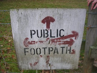
- [1] Come out of Ockley Railway Station and go through the car park, turning right down the tarmac station approach road. In 100 metres you come down to the road where you turn right under the railway arch. 10 metres beyond the railway arch, turn left off the road, following the public footpath sign, on a path between fences, your direction 200° initially. In 150 metres go over a metal bridge across a brook and bear right with the path. 250 metres further on you come out on to a narrow road. Turn right on to the road.
- In 25 metres you come to the entrance to a house called Weavers on your left-hand side. [!] Turn left, off the road, cross the house’s driveway, and continue along the path, following the public footpath sign on the corner of the driveway, your direction 250° initially. In 230 metres, having initially walked parallel to a driveway, the path takes a sharp left turn, going around the back of the garden of the big house on your left. 25 metres further on, it goes right again and continues in the same direction as before. In 100 metres you come to the edge of the trees and follow the path alongside a barbed-wire fence in the same direction as before.
- In 300 metres, at the far side of the field to your right, ignore a cross-path by a wooden post with a blue arrow. Continue straight ahead, going downhill, with a recent plantation of trees on your left-hand side. In 90 metres at the bottom of the slope, go over a wooden bridge with wooden handrails across the stream. Ignore a minor fork off uphill to the left in 5 metres, to continue along the bridleway as it makes its way through the trees, now uphill.
- Ignore ways off and in 340 metres go through a rusty metal fieldgate (usually propped open) into the field beyond. Walk across the field, gently uphill, your direction 260°. In 100 metres, when you reach the brow of this small hill (where once over to your left was an old water pump - mentioned in all editions of the TO Book - but now gone) [!] you have a choice of onward route. The original route took you straight ahead to the edge of the field directly ahead of you, where you turned left along the edge of the field with woodland to you right, to cross a stile part hidden in the corner of the field ahead. But you now have a permissive path over the grass from where the old water pump used to be. Bear half left across the grassy field , your direction 220° on this path which swings to the left.
- In 120 metres go through a wooden swing gate by a three-armed footpath post, next to a pylon, and turn sharp right up the field edge. In 75 metres, with the part-hidden stile on your right-hand side which you would have crossed if you were following the original route,
and keep ahead along the right-hand edge of the field, gently uphill, your direction 195° initially. - In 90 metres cross a stile and enter woodland. In 25 metres the path swings to the right your direction 260° initially. In a further 50 metres you come down to a lane, leading up to a wooden fieldgate on your left-hand side, with a gate marked ‘Private’ [2].
- Go straight across the lane, following the public footpath sign next to the right-hand gatepost, past a large oak tree, your direction 200°. In 40 metres go through a metal kissing gate to the right of a metal fieldgate. On your right-hand side you can soon see the village of Ockley. Walk along the left-hand edge of the grassy field, gradually descending as your way curves to the left. In 90 metres go over a stile to the left of a metal fieldgate in a field boundary (this fieldgate is often propped open). Continue downhill, on a grassy way.
- In 180 metres cross a path junction in the grass with a four-way sign and a stile to your left. In a further 85 metres enter a wood through a metal kissing gate to the left of a metal fieldgate. Keep ahead through the wood, ignoring all ways off, your initial bearing 200°, on a broad path cum track which starts level then gently rises. In 300 metres a path joins from the left. In a further 100 metres the path begins to descend.
- In 190 metres at a T-junction with a tree plantation to your left [!] your quaint directional marker used to be a beech tree 10 metres to the left (with ‘Anthony Annette Adam’ carved on it nearly 2 metres up) but alas, this tree has fallen down (in October 2020) and it is now on its side. But at this T-junction turn right with the path, your direction 255°, entering Birches Wood. After 45 metres by a cypress tree take the left-hand fork which bears to the right and in a further 45 metres by a footpath post with a yellow arrow to front and rear [!] turn left, steeply downhill , due south. 80 metres down the hill, with a two-armed footpath sign on your right, cross a wood and metal bridge with metal railings going over a stream. Once over the bridge, follow the path left for 10 metres and then around to the right up the hill, heading southwards, through woodland. In 150 metres, exit the wood by crossing over a stile (or pass to its left) and walk along a grassy bank and then a field with a hedgerow on the right-hand side, your direction 190°. In 200 metres you come to a metal fieldgate. Go through it and onto a car-wide farm track.
- [3] Eversheds Farmhouse (marked on the OS map) is straight ahead of you. Turn right on the farm track with the farm buildings to your right-hand side. Then simply follow the track through its bends: in 90 metres the track goes sharply around to the left; 140 metres further on, sharply around to the right. In a further 350 metres you come down to the bottom of a slight incline, sharply around to the right, over a concrete bridge with railings and continue uphill, your direction 305°.
- In 100 metres pass through a (usually) propped open pair of fieldgates and keep ahead, now on a concrete farm track. In a further 200 metres, the track having swung to the left, you come up to a concrete road, pass through a metal fieldgate (usually open) to come to a crossing of farm tracks with farm buildings off to the left and two steel feed silos closer by. Here [!] turn right, through a (usually open) metal fieldgate, with a blue bridleway arrow on its left-hand wooden gatepost, onto a gravel farm track which in 125 metres swings left.
- Continue past Mill Cottage on your left and as the track swings to the left, keep ahead to the busy A29 road which you cross over with care, to follow the public bridleway sign on the far side. In 15 metres, East Standon Lodge is on your right-hand side. Follow the car-wide track to the left, your direction 230° initially, with tree line on both sides, and in 450 metres you come to a wooden gate (leading to a house called Middle Lodge). Follow the wooden fence of this house round to the left . In 70 metres, at the end of the fence, keep on the path as it bears left, your direction 200°.
- In 100 metres, you go through a metal gate with a tall handle on the edge of Oakwood Mill Farm. Cross a lawn, with the farmhouse directly ahead of you, and in 25 metres turn right down a gravel path, your direction 265° initially. In 40 metres go over the river on a concrete bridge [4] Note route change here . The original TO book route had you turning left through a metal fieldgate some 20 metres from the end of the bridge. The gate has been locked in recent times, suggesting the onward route has changed to the following.
- From the end of the bridge keep ahead on the track as it swings to the right, gently uphill. In 40 metres go through a (usually) propped open fieldgate, or when closed, duck under the wooden barrier to its right, to enter a field, where you turn left up the field edge on a broad earthen path. In 70 metres turn right with the path and then within 10 metres turn left to cross a two plank bridge then a stile, to rejoin the original TO book route which turned left here, although having crossed the stile you keep ahead . Follow the line of the fence on your right-hand side, with the river down below on your left-hand side.
- In 300 metres, the next turning can be easily missed. [!] Where the path comes down to a dip you turn sharp right onto a path going up the hill with a fence to your right-hand side, your direction 300° initially. In 60 metres you come up into a field. Walk alongside the barbed-wire fence on the right-hand edge of this field, your direction due west initially. In 200 metres cross over the stile into the wood and follow the woodland track, in the same general direction as before. In 50 metres you come to a footpath post and fork left, your direction due west. 30 metres further on, there is another footpath post, where you ignore the fork slightly to the left to continue straight on (slightly to the right), your direction still due west.
- To detour to the Punchbowl pub in Oakwood Hill, take the fork slightly to the left (ahead), your direction 230°. Follow this path as it swings to the left, then descends a dip to go up the other side, now along the edge of the wood.
Ignore all ways off and some 475 metres along this path through a number of bends you come out onto a road, opposite a road sign for ‘Oakwood Hill’. Turn right, uphill, in 425 metres coming to the Punchbowl pub on your right-hand side.
After lunch, turn right and in 80 metres at a road junction (where to keep ahead would take you to Rosehill Cottage in 1 km) you bear left with the road (Honeywood Lane), in 1 km coming out at point [5A] in the Main Directions, where you rejoin the main route by turning left down the tarmac lane signposted to Monks Farm and Honeybush Farm. - But continuing with the main route: in 400 metres the path leads you down through the trees to the Parish Church of St. John the Baptist in Okewood. Go through the wooden gate into the churchyard and proceed to the church porch. This is the ideal spot on this walk for picnickers. If stopping here for your picnic lunch you can, if you wish, omit the loop to the pub in Walliswood and instead take a direct route to the road which connects you to Rosehill Cottage where you rejoin the main walk route. This short cut reduces the overall length of the main walk by 1.1 km. Directions for this short cut are as follows.
- Short Cut : from the church porch turn left to head back through the graveyard on a surfaced path. Go through bushes and you come to the red brick church hall (hidden from view from the church porch). Here you pick up a path and you keep ahead in a south westerly direction close to the left-hand edge of woodland, gently uphill.
In 240 metres with Chapel House now to your right the path swings to the left. In a further 180 metres you come down to the road which links Walliswood to Okewood Hill.
Turn right along this road and in 200 metres you come to Rosehill Farm and Rosehill Cottage on your left-hand side. Turn left to pick up the footpath within the grounds of Rosehill Farm (next to the Cottage) and rejoin the main Walk Directions. - To visit the The Hannah Peschar Sculpture Garden, go north for 500m along the lane, then turn left on a minor road. The entrance is on your right. Aftewards, retrace your steps to the church.
- The Main Walk continues : coming out of the church go down the path with stepping stones directly opposite the entrance to the church, your direction 260°. In 25 metres go through the gate and descend steps to go over a wooden bridge. In 40 metres at a T-junction, bear left, due west. In 30 metres cross over a wooden bridge, ignoring the similar bridge to the right. Continue ahead, bearing 270°, gently uphill.
- Ignoring all ways off, in 360 metres you have post and wire fences on either side of you. Keep ahead for a further 125 metres towards the end of the wood and, some 25 metres before the end, as a path joins from the left, with a gate, swing right with the path, now with a fence on your right-hand side, your direction 305° initially.
- Go straight on for 550 metres, ignoring ways off, to come out through a wooden kissing gate on to a road, where you turn right into the village of Walliswood . In 50 metres, you reach the Scarlett Arms pub on your right, the suggested lunch stop.
- Coming out of the pub after lunch, turn left back down the road. In 60 metres you pass a turning on the right to Ewhurst. In 120 metres further on, you pass a dead-end turning on your left called Oakfields. 60 metres beyond that, turn left , following signs to Oakwood Hill, Ockley and Dorking. You pass a house on your right-hand side called Charles Copse.
- In 400 metres you come to Rosehill Cottage on your right-hand side. Just beyond this, there is a public bridleway sign pointing to the right. Turn right off the road, and follow the bridleway which takes you to the left of Rosehill Farm's buildings on a broad earthen track Note [!] the original route took you through a wooden swing gate to the left of a wooden fieldgate then on through a scruffy farmyard: if the bridleway track is overgrown, revert to the route through the farmyard. Otherwise, in 90 metres along the bridleway track, the way peters out, and you swing right, then left to join the original path, now on a grassy way, along the left-hand edge of a field, with woodland to your left.
- In 300 metres, on the far side of the field, you go through a gap in the hedgerow into the next field. Walk straight ahead along the edge of this field, with the wood on your left, direction as before. In 250 metres you come to the corner of the field, by a three-armed footpath sign. Follow the yellow arrows, along the barbed-wire fence on your right-hand side, keeping ahead, with the edge of the wood on your left. This narrow path is often overgrown and you should take care as there is a ditch close to its left edge, waiting to catch your ankle.
- In 150 metres you come out from this overgrown path into an open field on the edge of the wood and here [5] your way ahead depends on where the farmer has set his electric stock control fences. Your target is a stile and small bridge some 90 metres away, over to your half-left, and slightly below you. To get there (since April 2024) keep ahead and make for the stile ahead of you in a section of wood fencing. Cross this stile and bear half left and slightly downhill towards the stile and small bridge. Go over the bridge and cross the stile, then turn right then left to head uphill, over a large field, on a bearing of 135° with a mesh fence on your left, heading to the right of a copse.
- In 200 metres you come up to trees where you will see that there is a barbed-wire fence going all around the copse. You should come up to the right-hand corner of this copse. Walk straight on, with the barbed-wire fence and trees over to your left, in the same direction as before. In 100 metres you come to the far side of the copse, where one fence goes sharply off to the left. Continue straight on across the field ahead, in the same direction as before. Aim for the gap in the hedgerow, a line of small trees ahead. In 20 metres you walk underneath overhead cables. 80 metres further on, cross over a concrete platform bridge, go over a wooden step and through the gap in the trees into the next field. Aim half left towards the far side of the field, your direction 120° and in 130 metres go over a stile to the right of a metal fieldgate and out onto a car road where you turn left.
- In 100 metres you will see a postbox on your left-hand side and on your right-hand side North Lodge, the gatehouse for Tanglewood. On the left-hand side of the road is a metal footpath sign pointing right across the road to the wooden sign to Tanglewood, within the lodge’s driveway. [!] Ignore this path (The Sussex Border Path) and instead turn right down the tarmac lane [5A], signposted Monks Farm and Honeybush Farm, with woodland on either side, your direction 205° initially.
- In 250 metres you come to a three-armed signpost on your right-hand side, with the entrance to Honeybush Farm also on your right. Follow the bridleway straight ahead for 30 metres to go through a wooden swing gate to the left of a security controlled metal fieldgate. 450 metres further along this surfaced drive you pass between two farmhouses and pass a barn on your right, and up to a T-junction [6] where there is a three-armed signpost, by a large oak tree. Ignore the Sussex Border Path 1989 which goes left at this point along the course of Stane Street (which is an old Roman Road). Turn right down the public bridleway. [!] Beware of unruly dogs here (and also earlier by the entrace to Honeybush Farm): have an extended walking pole at the ready.
- In 25 metres pass through a (usually) propped open wooden fieldgate and in 10 metres follow the track sharply around to the left, with a wooden fence on your left-hand side. 40 metres further on there is a two-armed signpost on your left-hand side. Here to you right is a pair of high wood panel gates marked Marylind Stud. Keep ahead and to the left of the gates on a bridleway and in 30 metres pass through a rusty metal fieldgate (once painted white) and recently resited from its original position adjacent to the stud gates. Keep ahead on a grassy way, which swings to the right, soon between hedges and bushes.
- In 120 metres from the rusty fieldgate follow the bridleway sharply around to the right, gently uphill, your direction 190° initially, with a wire fence on your left. 170 metres further on, where there is a metal fieldgate directly ahead, follow the bridleway as it curves around to the left , your direction 155° initially.
- 60 metres further on, there is a new wooden three-armed signpost on your right by the side of a new metal kissing gate in a new fenceline. Turn right through the kissing gate , to turn half-left over a grassy field and head for the left-hand corner of the field, where you can see another new metal kissing gate in the corner of the field ahead of you at the edge of a wood. In 80 metres go through this kissing gate with another new wooden three-armed footpath sign to its side.
- Head downhill through the wood on a path with an uneven footbed. In season you have a good display of bluebells on either side of the path. Some 300 metres down this path, you come to a wooden footpost where the path bears slightly to the right. 35 metres further on, look out for the three-armed public footpath signpost on your left-hand side. Go to it and turn left , due east, to go over a stile in 30 metres. Walk straight ahead, your direction still due east, with a field fence on your left-hand side, along the top of a bank, with oak trees to your right. In 170 metres you come out into a grassy field. Keep ahead along its left-hand edge.
- In 35 metres you come to a two-armed footpath sign on your left-hand side. Follow the direction of the footpath, going left towards some farm barns, your direction 10°. A fence has recently been erected around the barns. Whereas previously your route took you to the left of the barns, to follow the field edge to your left, you now turn right and walk around the barns, then left , following the fenceline. At the end of this left turn along the fence, by a footpath post with arrows on your left, [!] turn right across the grassy field, following the sign’s direction, 70°, bearing slightly left, aiming for a metal fieldgate in the top left-hand corner of the field, with a farmhouse over to your left.
- In 200 metres pass through this fieldgate with a three-armed footpath sign to its left. Bear right and head down a public bridleway, your direction 100° initially, with treeline on both sides. In 150 metres you pass metal fieldgates on both sides of the path and continue straight on down the hill. 125 metres further on, cross over a wooden bridge with handrails over North River. On the other side of the bridge, do not go through the gate ahead but turn right along the riverbank, following the direction of the public bridleway sign. You have a good display of wild garlic here in season. In 60 metres cross over a stone bridge with wooden railings going over a stream and continue straight on uphill up the path on the other side, in a light woodland strip.
- In 250 metres you pass a gatepost and come out onto the main road (the A29). Cross straight over the road and follow the public bridleway sign up the car-wide track on the other side. In 30 metres pass either side of a wooden fieldgate (with marker signs for Pear Tree Farm and Bridleway) and bear slightly left with the track, again in a woodland strip. In 120 metres follow the direction of a two-armed signpost on your right, directly ahead, along the bridleway through the trees. In 100 metres you pass Pear Tree Farm on your right-hand side. Now on a gravel drive, in 250 metres you come out on to a road, alongside a rather sinister half-timbered old building of mixed styles called Maltmayes on your left-hand side. Turn right onto the tree-lined road and walk up the hill. In 20 metres ignore the public footpath going off the road to the left. 300 metres further on, you pass a driveway on the left-hand side, leading to a very tall clock tower (an old water tower, built in 1891 for the Warnham Lodge Estate and redundant since the mid-1930s).
- 200 metres beyond the tower, the road curves sharply around to the left. Ignore the first way off to the right (a track between wooden posts) but just beyond it you turn right off the road, following a bridleway sign on the corner, going straight ahead, due south. Follow the path to the left of the bridleway, making its way through the trees, beside railings along the left-hand edge of the wood (or in non-muddy conditions just walk up the bridleway).
- After 500 metres along this winding, narrow woodland path, keeping near to the railings on your left-hand side whenever there is a choice, the path goes steeply downhill. 25 metres from the start of this hill, your way is rejoined by the at-times muddy bridleway coming in from the right. Follow the bridleway straight across the bottom of the depression and straight up the far side, your direction 235° initially. Ignore a path that forks off to the right.
- In 200 metres you come over the hill and down to a four-armed sign on your right. 10 metres before this sign [!] turn left off the bridleway, [7] go up three new earthen steps cut into a bank of tree-roots and at the top of the bank keep ahead on a footpath along oak trees lining the left-hand edge of a field, your direction 125° initially. Note: at point 7 the extension to Horsham bypassing Warnham starts .
- In 400 metres you pass through a field boundary (a woodland strip) with a three-armed public footpath sign on your left and bear left , following the path along the left-hand edge of the next field, your direction 70° initially. In 80 metres you come to another three-armed public footpath sign (part hidden in bushes on your left) and keep ahead, bearing slightly right, to carry on around the field, your direction 105° initially.
- In 80 metres you come to a two-armed public footpath sign on your left. [!] Follow the sign, half right down across the field towards Warnham, your direction 120°. In 125 metres by a two-armed footpath sign, go through a gap in the hedge in a field boundary and continue in the same direction across another field. In 120 metres you come to the edge of this field and continue straight on through the gap in the hedge and trees. When you come into the next field, you can see a development of red brick houses on your right-hand side. Continue on, with the fence surrounding this development on your right, down the hill, in the same direction as before, through light woodland. In a further 100 metres, you come to the edge of this field. Follow the path ahead through the trees. The path takes you down through the trees, past a wooden barrier and out onto a road.
- Cross straight over the road (Tillets Lane) and down Lucas Road opposite. In 150 metres you pass Hollands Way on the right. 100 metres further on, you come to a dead end at Warnham Church of England Primary School. Go down a concrete footpath to the right of the school. 150 metres down this footpath you pass a three-armed footpath sign on the right-hand side and continue straight on. In another 100 metres you come out on to the road opposite the church. 50 metres down the road, on your right-hand side, is the village store and post office, which can be relied on for ice cream, cakes and snacks. In the opposite direction, on the left-hand side of the road, is the Sussex Oak pub, the suggested tea place.
- To extend the walk to Horsham, follow the instruction below.
- Otherwise to get to the railway station, walk down Bell Road, directly opposite the Sussex Oak, signposted “Horsham 2 miles”. In 500 metres you come to a T-junction on to a major road (the A24). Cross straight over this busy road with care and turn left in the direction of London and Dorking. In 30 metres turn right, following the sign for Warnham Station. As you walk along this road, you can see the brickworks up on the left. Just walk straight up the road for 700 metres until you come to Warnham Railway Station directly ahead of you. The platform for trains to London is the one on the left before the level crossing.
Extension to Horsham
Note: You no longer need to attempt a dangerous crossing of the busy A24 road as you approach the outskirts of Horsham. A safer route is now provided in the directions which follow.
- Coming out of the Sussex Oak pub cross the road and turn right. At the end of the churchyard wall turn left onto a foot path, initially between fences, with the churchyard on your left. At the end of the churchyard bear left over open ground with some trees.
- Some 300 metres from the road, at a three-armed footpath sign, pass through a field boundary and take the right fork diagonally across a vast open field, your direction 130° [!] Note: this path was closed off in April 2025 at both ends and until it reopens you have to take the left-hand fork instead,turning right at field-end to walk parallel to the road on your left to rejoin the diagonal path where it meets the path as noted below.
- The diagonal, right fork path continues: In 40 metres you pass an isolated oak tree on your right-hand side. In 350 metres, by a two-armed footpath sign, pass through a gate frame and onto a path, with a fence on your left and treeline on your right. Keep ahead and in a further 250 metres you come to a T-junction with an old road, where you turn right. Head along this road (Daux Hill) with woodland to your left (and the A24 road behind it), and the Warnham Park Estate's 1.5 metre high brick boundary wall on your right.
- In 250 metres, by a three-armed footpath sign do not turn left off the road into the wood, as the path ahead will commit you to a dangerous crossing of the A24 road, the equivalent of a 4-lane motorway at this point.
- Instead, keep ahead on the old road - Daux Hill - and in 310 metres, as the road swings to the right [!] turn left off the road down the access road to Rookwood Golf Course and the Warnham Barn . In 90 metres go through a tunnel under the A24 road. At the end of the underpass keep ahead as the access road swings to the right .
- In 150 metres the access road swings to the left. In a further 90 metres turn left through a wooden fieldgate, in the direction of the bike sign to Horsham 1.25 miles (sign over to your right). Cross a golf fairway on a gravel track and in 75 metres cross a concrete bridge with brick headwalls over a stream. Keep ahead and cross another fairway.
- In 65 metres at a path junction turn right and in a further 20 metres turn left over a steel and wooden bridge with wooden handrails over a stream, following the direction of a green public footpath sign. Keep ahead on a gravel path through bends in light woodland and in 100 metres you exit the golf course onto Redford Avenue in Horsham's suburbia.
- Cross the road, turn right then left into Spencers Place, uphill. In 300 metres this road changes its name to Kempshott Road.
- At the T-junction in 400 metres, with Premier Corner Shop and Post Office ahead, turn right into Trafalgar Road, which in 100 metres swings to the left.
- In 250 metres turn left into Rushams Road.
- In 150 metres at a T-junction with North Parade (road) turn right and in 25 metres cross the road at a traffic island and enter Horsham Park where you turn right . Keep ahead down - or close to - the right-hand edge of the park.
- In 340 metres you need to decide if you want to go directly to the railway station or via the centre of Horsham with shops and potentially further tea rooms (they close at 17:00) and pubs.
- Here, you have a choice.
- Directly to the railway station:
- Turn half left and walk across the grassy lawn towards the right corner of the trees surrounding a duck pond.
- Continue along the right-hand edge of the duck pond through an entry and exit gate.
- At the end of the duck pond turn half left towards the swimming pool (direction 90°)
- At the gate of the swimming pool turn right along it. Go past the swimming pool and the path veers right towards Horsham railway station.
- To the railway station via the centre of Horsham:
- Continue on the path and in 200 metres turn right towards the underpass of Albion Way and towards the centre of town.
- For the railway station walk along the eastern edge of Carefax towards The Spire.
- Cross Albion Way over a foot bridge and continue in the same direction for 500 metres towards Horsham railway station.
Extension to Horsham bypassing Warnham
- At point 7 in the main walk directions, do not turn left up earthen steps but instead [!] keep ahead on the sunken bridleway, now downhill.
- In 285 metres the bridleway swings 90° to the left, by a two-armed footpath sign, with Warnham Manor ahead of you. In 210 metres the path swings to the right and in a further 90 metres cross the entrance drive to the manor house, with its gated entrance to your immediate right.
- Cross a stile into the field ahead of you, with a metal fieldgate some 5 metres to the right of the stile. Turn left along the field edge on a grassy way, your direction 100°.
- In 100 metres go through a gap in the field boundary and in 10 metres bear half-right to cross over a field, your initial direction 150° aiming for a house at the far side of the field. In 270 metres pass a coppice of mature oak trees on your left and keep ahead, slightly right. In 100 metres cross a grassy farm track and bear half right , with Ridge House to your right.
- In 200 metres, at the end of the field, cross a stile, then a two plank bridge to come out onto a road. Turn right along the road, and in 160 metres, just after a left-hand bend in the road, [!] turn left at a footpath sign to follow a path along the edge of woodland, your direction 140°.
- In 110 metres go through a deer protection gate to come out into a Bailing Hill Deer Farm . You are now going to head gently downhill through a number of deer paddocks on grassy ways. In 130 metres pass through a deer protection gate and keep ahead. In a further 55 metres go through another deer protection gate and keep ahead down a path. In a further 60 metres pass through two deer protection gates, a few metres apart, to come out onto a farm track.
- Keep ahead, soon passing farm buildings, and in 105 metres you come out onto Bailing Hill Road . Cross over this road and pass through a metal kissing gate to enter the Warnham Park Estate . Follow the public footpath through this private estate, following black and white marker posts, on a grassy way, your direction 140°.
- In 575 metres exit the park through a rusty, deer protection gate to come out onto Robin Hood Lane . Turn left along this at-times busy road, taking care as there is no pavement. In 400 metres, as the road swings sharply to the left, to become Daux Hill, keep ahead on the access road to Rookwood Golf Course and The Warnham Barn .
- Now follow the directions in the Extension to Horsham section above .