Ramsgate to Margate via Broadstairs and Botany Bay walk
Easy coastal walk with fine cliff top views, 3 classic seaside resorts, and a number of stunning sandy bays and coves that make it a great swimming walk


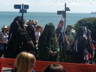
Wild Hunt Bedlam Morris,
Now here's an idea for next year - a mummers play based on "The Fog" Ramsgate to Margate Broadstairs Folk Week
book3 swcwalks walk101 4880091948
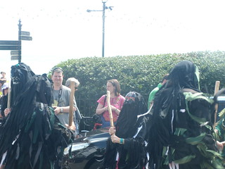
Wild Hunt Bedlam Morris,
If you ever wondered what the walk posters look like, here's one. Not sure which one but here's one. Ramsgate to Margate Broadstairs Folk Week
book3 swcwalks walk101 4879485347
| Length | 15.7km (9.8 miles) |
|---|---|
| Toughness | 2/10 |
| Maps |
OS Explorer 150 |
| Walk notes |
This is a gentle coastal walk linking 3 historic coastal towns (Margate, Broadstairs, Ramsgate) on the Isle of Thanet (NE Kent). Much of the walk is along low chalk cliffs with views over the channel, with several secluded coves. At low tide, you can walk along the beach between them. The 3 resorts are very busy on sunny days, but the rest of the coast is much quieter. This is the farthest corner of the Isle of Thanet is arguably where the east coast of England meets the south coast, though the gently curving coastline makes it hard to identify a precise turning point. For much of the way it is possible to choose between walking on top of the 20-30 metre high chalk cliffs ("cliff top level"), or at low tide, walking along the beach or promenade below ("beach level"). Although this stretch of coast is largely built-up, there is a wide strip of open grass along most of the cliff top. The beaches are sandy and flat - the tide goes out a long way. The walk can be done "clockwise" (starting in Margate) or anti-clockwise (starting in Ramsgate or Broadstairs). Clockwise allows 2 possible endings, so you can choose between a medium and a longer walk. Anticlockwise give you 2 possible starts. These notes, and directions below, assume "anticlockwise". Check the tide times. The Margate end of the walk is nicer at low tide. It is a series of bays which are joined together at low tide. At high tide, you need to use the cliff top path between them, at low tide, you can walk along the beach. If starting in Ramsgate its the middle / end that's best at low tide, if starting in Margate ("clockwise"), its the start / middle which are best at low tide. Apart from the small part to/from Ramsgate station, the route is pretty easy - just follow the coast, swapping between the cliff top path and the beach as you wish and the tide dictates! Ramsgate has an interesting old town area, a harbour with a harbour arm to walk along, with a bistro at the end, and a large new Victoria Pavillion (A Wetherspoons pub). There are some quiet beaches with beach cafes on the way to Ramsgate, its a mix of sea path and slippery rocks or cliff top path through a park. Broadstairs also has an interesting old town, as well as a sandy beach and links to Charles Dickens. After quieter beaches, there's a choise between a short inland detour or rocky beach walking below (at low tide). Next is a series of sandy coves, you can walk between them at low tide, or use the cliff top path above. Of these, Botany Bay is the most secluded and prettiest beach - its western end (only) with sand dunes is discreetly used by naturists. From the west, its entrance (from cliff top level) is easy to miss. By the main entrance (at its eastern end), are some picturesque stacks and an arch. From here, its a concrete promenande, passing a tidal bathing pool all the way to Margate. Margate, while not so historic/pretty as the others, has a large new art gallery (free), a harbour arm protecting the beach (bars), and many pubs and cafes. This walk is also being promoted as the Viking Coastal Trail cycle route ([link 1], [link 2] ) - the first website has a good map, and a PDF of the route leaflet, with interested history about the route |
| Walk options |
|
| Transport |
Southeastern’s High Speed service from St Pancras, with limited stops, has considerably shortened journey times to the Thanet coast. The traditional stopping service from Victoria or Charing Cross may still be an easier option, however, for those living in south London Suggested train : Catch the train nearest to 9.45am from St Pancras, or nearest to 9.00am from Victoria. Journey time to Ramsgate is 1 hour 18 minutes or 1 hour 55 minutes respectively. By Car: park for free by the coast pretty much anywhere away from the centre's of the large towns and their stations. There are even some free beach level car parks around Palm Bay. Local Transport: There is a regular and inexpensive bus service which follows the coast road if you which to cut the walk short or return to you car. |
| Lunch and Tea |
1 km : The Royal Victoria Pavillion - Highly recommended. A very large new Wetherspoons pub (Summer '17) in a restored seafront heritage building, with a sun terrace overlooking the harbour and beach. Very cheap for the location. Free parking along the cliff top road above (Wellington Crescent). 1 km: Opposite the Victoria Pavillion, is Peter's Fish Factory (Fish & Chps), award winning, recommended, cheap. 1 km : Royal Harbour Brasserie, at the end of the harbour arm, terrace, harbour views, great spot for sunset. Parking. 2 km : Sams, CT10 1TD, a small beach cafe at the bottom of the path leading down to Dumpton Gap beach. Recommended. 2.5km : Louisa Bay Cafe, a small beach cafe at Louisa Bay, summer only, great location, recommended. Summer (Easter to Spetember) only. 3 km : The The Charles Dickens, Victoria Parade, Broadstairs, with views over Viking Bay, serves good value food all day. Its near the Charles Dickens museum about half way round the main beach, near the road inland to the station. There are many other pubs and eating places in Broadstairs, mainly in Albion Street and Harbour Street, near the seafront and harbour. 4 km : Kiosk on East Cliff at beach level. 7 km : The Captain Digby pub at cliff top level at Kingsgate Bay. Good value, popular, family friendly, terrace overlooking the beach. 8 km : The The Botany Bay pub (was The Fayreness) a popular good value food pub at cliff top level just after the main entrance to Botany Bay beach. 10 km : Palm Bay - 'jet ski' cafe at beach level 12 km : Margate : The harbour arm has The Lighthouse Bar, a micro pub and a cafe, all with terrace and nice harbour views 13 km : Margate : Many places, including The Mechanical Elephant, a Wetherspoons on the main seafront road, about 200m from the station. |
| Tides |
27-Jul :
high: 05:00
low: 11:13
high: 17:01
low: 23:59
28-Jul :
high: 05:49
low: 12:02
high: 17:52
29-Jul :
low: 00:49
high: 06:45
low: 13:00
high: 18:54
30-Jul :
low: 01:51
high: 07:55
low: 14:14
high: 20:08
31-Jul :
low: 03:02
high: 09:06
low: 15:33
high: 21:24
01-Aug :
low: 04:15
high: 10:15
low: 16:53
high: 22:40
02-Aug :
low: 05:23
high: 11:16
low: 18:03
high: 23:42
Times for . Corrected for BST if appropriate. Contains ADMIRALTY® tidal data: © Crown Copyright and database right.
|
|---|---|
| Profile | |
| Help Us! |
After the walk, please leave a comment, it really helps. Thanks! You can also upload photos to the SWC Group on Flickr (upload your photos) and videos to Youtube. This walk's tags are: |
| By Train |
Out (not a train station) Back (not a train station) |
| By Car |
Start CT11 7RE Map Directions Return to the start: Finish CT9 5AD Map Directions Travel to the start: |
| Amazon | |
| Help |
National Rail: 03457 48 49 50 • Traveline (bus times): 0871 200 22 33 (12p/min) • TFL (London) : 0343 222 1234 |
| Version | |
| Copyright | © Saturday Walkers Club. All Rights Reserved. No commercial use. No copying. No derivatives. Free with attribution for one time non-commercial use only. www.walkingclub.org.uk/site/license.shtml |


Walk Directions
Anticlockwise: Ramsgate to Broadstairs to Margate
In many places you can choose between a cliff top path, a beach level promenande, or the beach itself.
Ramsgate Station to Dumpton Gap
- Exit Ramsgate station through the booking hall and turn right down Wilfred Road, passing a Royal Mail building on the right.
- At the bottom of the road, at traffic lights, turn left, cross the road and in 60 meters turn right through iron gates into Ellington Park, and turn left.
- Just before reaching a children’s playground, exit the park and turn right down High Street. In 800 meters continue ahead down a pedestrianised section of the street (there is a busy street market here on Fridays and Saturdays).
- At a road junction, continue ahead down Harbour Street to reach Ramsgate Royal Harbour. Go forward along Harbour Parade, passing the marina on your right.
- Keep straight on, passing the Royal Victoria Pavilion on your right (recommended, now a Wetherspoons pub in a restored heritage building, with a terrace overlooking the harbour and sea). Carry on along the eastern promenade, with the sea and Ramsgate’s main beach to your right.
- Continue along the promenade, under high chalk cliffs, presently passing the smaller East Beach to reach some brown stone steps.
- The promenade comes to a dead end soon after the steps, but you could continue alomg the half rocky half sandy beach at low tide for 1km to Dumpton Gap.
- Climb the brown stone steps to reach the clifftop. Turn right on a tarmac path, and just after the path bends left, turn right into Memorial Park, keeping straight on along the main path, with a fence to your right. (In the park is a small Italinate Greenhouse with a cafe, closed in 2017, it on the upper, road side of the park)
- On leaving the park, continue straight ahead along the wide grassy clifftop, with a road to the left.
- The cliffs dip down at Dumpton Gap, where a footpath leads down to the sea, with a promenade backed by a small cluster of beach huts and a nicely situated café. There is no actual beach here at high tide.
Dumpton Gap to Broadstairs
- At low tide, you can walk along the beach to Louisa Bay and on to Broadstairs
- Continue along the grassy clifftop, past Louisa Bay (with a small beach cafe) to arrive at Broadstairs beside the bandstand, overlooking the curve of Viking Bay which encloses Broadstairs’s main beach.
- You can choose between the high promenade, or crossing the sandy beach
- Go along the promenade above the beach, coming to the Charles Dickens pub (the recommended lunch stop) over on the left. Almost next door is the Dickens House Museum, where you can turn left (inland) to find many other eating places on Albion Street, running parallel to (and behind) the promenade.
- For Broadstairs station: go straight on up the High Street (past Iceland and a Tesco Metro) to reach the station in 600 meters.
Broadstairs to Joss Bay
- From Broadstairs station: Exit the station, walk down the High Street to the sea (600m), and turn left along the promenade
- Coming out of the pub, turn left to continue along the promenade, which soon slopes down to join Harbour Street running down towards the short pier arm that encloses the harbour.
- On reaching the pier, keep going northwards along the promenade running between the sea and the cliffs. Just round the bend is Stone Bay, a long, narrow, crescent-shaped beach, whose promenade is lined with beach-huts.
- At the far end of the promenade, you reach steps that go up, inland.
- The upper path is about 1.5km long, with a short detour (about 300m) away from the cliff edge around houses. At low tide you can continue along the rocky/sandy beach below to Joss Bay. Beware that the rocks are covered with seaweed and can be very slippery.
- Turn left up steps (inland) and then along a footpath to reach North Foreland Road, where you turn right.
- In about 200 meters, turn right into North Foreland Avenue, and right again into Cliff Road (back towards the coast), which later turns left to become Cliff Promenade, running close to the clifftop.
- At the end of this road, go straight on, past a wastewater pumping station, on to a footpath that follows close to the edge of the unfenced cliff. Over to the left is the North Foreland Lighthouse, the last in the country to be converted to automatic operation, in 1998.
- Ahead is the sandy cove of Joss Bay, a popular family beach.
Joss Bay to Kingsgate Bay
- At low tide you can walk at beach level around the short headland to Kingsgate Bay, there is a short stretch of slippery seaweed covered rock
- Go through the car park, cross the main road into Elmwood Avenue, and immediately turn right on to a tarmac footpath that runs parallel to the coast road.
- In 200 meters you rejoin the road and turn left, taking great care, since the road is narrow and there is no pavement for the next 80 meters. As the pavement restarts, you pass the entrance to Kingsgate Castle (1760), now divided into luxury residential flats.
- Continue down the road to Kingsgate Bay, another fine sandy beach, noting the impressive arch in the white cliffs on the far side of the bay.
Kingsgate Bay to Botany Bay
- At low tide only, you can walk past the arch to Botany Bay
- Keep on the road, heading uphill to the Captain Digby pub, and turn right through the pub terrace on to an enclosed footpath that heads out to the base of a ruined flint tower on the headland beyond. Look back across the bay for a fine view of the castle.
- Continue along the grassy clifftop, which presently slopes down to Botany Bay, with its isolated chalk stacks formed by erosion of the cliffs. This popular beach stretches for about 900 meters north-eastwards to Foreness Point. The far end of the beach has some low sand dunes and is the quietest area of beach found during this walk. Its used by naturists.
- There are 2 ways down to the beach. The first is just before The Botany Bay, a pub set a little back from the cliff top. The other is about half way along the beach, and is less accessable. Its a short sandy scramble down the low cliffs from a point that is easy to see from below but hard to identify from above. Its by 'keep away from the cliff edge' sign.
Botany Bay to Margate Station
- At very low tide (only) you can walk around the headland to Palm Bay. At mid tide, there's a slopping concrete ledge, covered by very slippery alage, and at high tide its cut off completely.
- Carry on along the cliffs through an area of rough grassland, past a disused sewage pumping station at Foreness Point and then above the beach at Palm Bay.
- From here on you can choose the cliff top path, or the wide beach level concrete promenade (safe at any tide)
- Passing the next bay, Walpole Bay, note the large sea water bathing pool, which retains a great expanse of water by the shore for swimmers to enjoy at low tide.
- Continue along the cliffs, passing to the left of the Lido (whose swimming pools are now derelict) and then past the Winter Gardens. Join the road and descend Fort Hill towards Margate Harbour, passing the new building of the Turner Contemporary Gallery (free entry) and its cafe.
- On reaching the harbour, do explore the harbour arm. It has some nice small pubs.
- Afterwards, follow the road around its edge (or walk across the sands at low tide) and continue alongside the vast expanse of Margate Sands, passing a clock tower to your left.
- Pass the Mechanical Elephant, a Wetherspoons pub.
- When opposite Dreamland, cross the road at a pedestrian crossing, turn right, and just round the next corner Margate station can be seen almost straight ahead. About 100m further along the seafront road is a Tesco Metro.