Sheffield to Bamford or Moscar Lodge via Burbage Rocks and Stanage Edge walk
From Sheffield's urban centre through narrow valleys and across wild moorland to the Dark Peak's gritstone edges, and a lush finish into the Hope Valley

A Walker on Stanage Edge
SWC Walk 266 - Sheffield to Bamford (via Burbage Rocks and Stanage Edge) or to Moscar Lodge
Jun-16 • thomasgrabow on Flickr
swcwalks swcwalk266 banner walkicon 27831445076
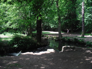
Porter Brook in Endcliffe Park
SWC Walk 266 - Sheffield to Bamford (via Burbage Rocks and Stanage Edge) or to Moscar Lodge
Jun-16 • thomasgrabow on Flickr
swcwalks swcwalk266 walkicon 27763929812

Houndkirk Road, through Burbage and Houndkirk Moors
SWC Walk 266 - Sheffield to Bamford (via Burbage Rocks and Stanage Edge) or to Moscar Lodge
Jun-16 • thomasgrabow on Flickr
swcwalks swcwalk266 walkicon 27588634650

Burbage Moor from Houndkirk Road
SWC Walk 266 - Sheffield to Bamford (via Burbage Rocks and Stanage Edge) or to Moscar Lodge
Aug-17 • thomasgrabow on Flickr
swcwalks swcwalk266 walkicon 36521802346
![Higger Tor and Carl Wark from Burbage Bridge SWC Walk 266 - Sheffield to Bamford (via Burbage Rocks and Stanage Edge) or to Moscar Lodge [via Carl Wark and Higger Tor Alternative]](https://live.staticflickr.com/4437/35758726923_2efe485394_n.jpg)
Higger Tor and Carl Wark from Burbage Bridge
SWC Walk 266 - Sheffield to Bamford (via Burbage Rocks and Stanage Edge) or to Moscar Lodge [via Carl Wark and Higger Tor Alternative]
Aug-17 • thomasgrabow on Flickr
swcwalks swcwalk266 walkicon 35758726923

Sheaf Square, Midland Station and Park Hill Estate
SWC Walk 266 - Sheffield to Bamford (via Burbage Rocks and Stanage Edge) or to Moscar Lodge
Jun-16 • thomasgrabow on Flickr
swcwalks swcwalk266 27789048921

Sheffield General Cemetery
SWC Walk 266 - Sheffield to Bamford (via Burbage Rocks and Stanage Edge) or to Moscar Lodge
Jun-16 • thomasgrabow on Flickr
swcwalks swcwalk266 27763612822
| Length | 25.5 km (15.9 mi), with 645/548m ascent/descent. For a shorter walk and an alternative ending see below Walk Options. |
|---|---|
| Toughness | 7 out of 10, with 6 ¾ hours walking time. For the whole outing, including trains, sights and meals, allow at least 13 hours. |
| Walk Notes |
This walk leads from the centre of one of the most populous British cities through gradually less urban areas into excellent wild walking country (think ancient woodlands, tumbling streams and panoramic views) on to the rugged moorlands and dramatically sculpted gritstone outcrops (or ‘edges’) of the Peak District’s iconic Dark Peak area. All in the one day, on the same walk, just two hours from London.
An Alternative Ending follows Stanage Edge to its end and descends to a bus stop on the A 57 Manchester Road, with an optional extension to the Ladybower Reservoir and its Inn for a longer stay in the area. |
| Walk Options |
To cut some – or all – of the tarmac-heavy urban stretches at the start take one of the bus shortcuts, either from Sheffield Interchange (150m from the train station), or a little higher up the hill in the City Centre along Arundel Gate (bus stops change all the time, check online for up-to-date information). Details about the bus stops to disembark at and the exact route from there to the walk route are provided at the end of the main walk text under ‘Bus Shortcuts’.
An Alternative Start from Grindleford (up Padley Gorge to The Fox House Inn) cuts 10.1 km/6.3 mi.
|
| Maps | OS Explorer: 278 (Sheffield & Barnsley) and OL1 (The Peak District – Dark Peak Area)
OS Landranger: 110 (Sheffield & Huddersfield) Harvey Superwalker XT25: Peak District Central (but not the urban bit to the Forge Dam) Harvey British Mountain Map: Dark Peak (but not the urban bit to the Forge Dam) |
| Travel |
Sheffield (Midland) station, map reference SK 359 870, is 227 km north north west of Charing Cross and 54m above sea level. Hollow Meadows (adj. Moscar Lodge) bus stop, map reference SK 231 879, is 13 km west of Sheffield City Centre and 359m above sea level. Both are in South Yorkshire. Bamford station, map reference SK 207 825, is 16 km south west of Sheffield, 151m above sea level and in Derbyshire. Sheffield Station is the terminus of the Midland Main Line from London St. Pancras, with up to two trains per hour (journey time from 121 mins Mondays-Saturdays, longer on Sundays). Bamford Station is on the Hope Valley Line from Manchester, with a journey time of 24 mins to Sheffield. Hollow Meadows (adj. Moscar Lodge) is a bus stop on lines X57 (Manchester – Sheffield Interchange) and 257 (Castleton/Bakewell – Sheffield Interchange). Saturday Walkers' Club: Take a train no later than 9.00 hours. |
| Elenvenses and Lunch |
Forge Dam Café Carr Forge Dam, Fulwood, Sheffield, South Yorkshire, S10 4GN (0114 230 9248). The Forge Dam Cafe is located 7.0 km (4.4 mi) into the walk on the fringes of Sheffield.
|
| Tea |
The Anglers Rest Main Road, Bamford, Derbyshire, S33 0DY (01433 659 317). The Anglers Rest is located 1.1 km off-route, 1.2 km from the end of the walk.
|
| Profile | |
|---|---|
| Help Us! |
After the walk, please leave a comment, it really helps. Thanks! You can also upload photos to the SWC Group on Flickr (upload your photos) and videos to Youtube. This walk's tags are: |
| By Train |
Out (not a train station) Back (not a train station) |
| By Car |
Start S1 2BP Map Directions Return to the start: Finish S33 0AH Map Directions Travel to the start: |
| Amazon | |
| Help |
National Rail: 03457 48 49 50 • Traveline (bus times): 0871 200 22 33 (12p/min) • TFL (London) : 0343 222 1234 |
| Version |
Apr-24 Thomas G |
| Copyright | © Saturday Walkers Club. All Rights Reserved. No commercial use. No copying. No derivatives. Free with attribution for one time non-commercial use only. www.walkingclub.org.uk/site/license.shtml |


Walk Directions
Full directions for this walk are in a PDF file (link above) which you can print, or download on to a Kindle, tablet, or smartphone.
This is just the introduction. This walk's detailed directions are in a PDF available from wwww.walkingclub.org.uk