Harpenden to St Albans Walk
A Hertfordshire Town and a Hertfordshire City linked by commons, parks, a country estate and a new woodland forest.


| Length |
17.58 km (10.92 miles). Ascent: 201 metres; Descent: 209 metres. Walking time: 4.5 hrs. |
|---|---|
| Toughness |
3 out of 10 |
| OS Maps | Explorer 182 |
| Features |
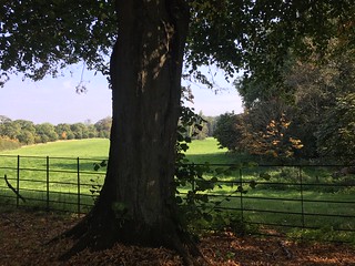
The walk links a wealthy Hertfordshire town with a historic Hertfordshire city, and is green and pleasant throughout. There is attractive common land, a forest with countryside views, a country estate, and finally a pleasant approach to St Albans which takes you through the old town past sites of historical interest. The morning highlight is the brand-new forest called Heartwood. See “History” below. It will be interesting to see how this part of the walk changes as the forest grows and develops. The afternoon takes you through the pretty Childwickbury country estate, with views also out to another estate, Gorehambury. A further highlight is then the city of St Albans, where you pass old pubs, quaint houses, the Roman museum and remains, the Cathedral and its gate, and finally the clock tower and museum of St Albans. |
| Walk Options |
You can reduce the length of the walk by more than four miles by taking a more direct route from Harpenden golf course to the Hertfordshire Way, a mile west of Sandridge Village, but this is not recommended as you would by-pass Heartwood Forest - the main raison detre for this walk. From one of the lunch pubs in Sandridge Village you can take a taxi to St Albans. There are busses in this village to St Albans but they are infreqent. |
| History |
Harpenden is a wealthy commuter town with a population of 30,000. Unlike some soleless dormitory towns in the South-East, Harpenden has a character of its own, enhanced by its semi-rural setting and its abundance of parks and green spaces. With its excellent sports facilities, outstanding schools, and fast rail services to London, perhaps it is not surprising that property prices in Harpenden are some of the highest in the UK. Heartwood Forest is a new forest created by the Woodland Trust. Until 2009 the land it now covers – some 858 acres – was arable farmland. The Trust planted hundreds of thousands of trees to create “the largest new, continuous native woodland in England”.It will be interesting to see how this part of the walk changes as the forest grows and develops. St Leonard's Church, Sandridge is a 900 year old Norman Church, with only a few of its original features remaining. The Church was substantially rebuilt in 1886 to give its present date appearance. The Lychgate was erected in 1921 as a memorial to the 24 villagers who died serving King and Country in the Great War. 6 names were added after the Second World War. In the roof of the Church are etched the names of the villagers who served in the Great War and survived the conflict. Childwickbury Country Estate is an 1,100 acre estate, dating from the 17th century, and comprising a Manor House, 18 houses and cottages, 2 farms, a stud farm, parkland and commercial woodland. Previous owners of the estate include the Lomax family, Sir John Blundel Maple (of Maple furniture fame) and Henry Joseph Toulmin, who commissioned the building of St Mary's Church, Childwick Green within the estate, and the adjoining school house. The simple little red brick church was designed by Sir Gilbert Scott, and has a tile roof and a shingled spirelet. Inside, its main feature is its beautiful marble font, in memory of some of the Maple family children. In the cemetery is the Maple Vault, where the coffins of Sir John and Lady Maple and their three daughters are interred. In 1978 the Manor House and part of the estate was purchased by the late film director Stanley Kubrick . His widow still lives in part of the main property. St Albans is a city steeped in history. It was the first major town on the old Roman Road of Watling Street for travellers heading north, and was originally known in Roman times as Verulamium. The city was later named after Alban, the first British Saint, who was martyred by the Romans in the third century for refusing to renounce his Christian faith. St Albans Cathedral (originally an abbey) and its monastic buildings was completed in 1088 with bricks from the Roman town (dismantled because it had become a hiding place for robber gangs). In 1381 its Great Gateway was besieged during the Peasants’ Revolt; it was later used to imprison the rioters. In 1455, during the War of the Roses, Henry V1 was wounded in the neck by an arrow and took refuge in the Abbey, while drunken Yorkists ransacked the town. The Cathedral is open daily until 5.45 pm; outside these hours you can enter for evensong at 5.00 pm weekdays, 4.00 pm Saturdays and 6.30 pm on Sundays. The excellent Verulamium Museum entrance (2024) £8, or £9 with the Roman Theatre, open Monday to Friday 10.00am - 4.30pm, Saturday 10.00am -3.30pm, stands in the middle of the site of the Roman city of Verulamium, once one of the largest towns in Roman Britain. The site is now a pleasant city park. Very little of the city remains - a Hypocaust’s mosaic and some city walls. Outside the park is a Roman theatre (mainly earthworks, few walls remain - £3 entry (2024)- 10am-5pm/4pm winter). |
| Travel |
During British Summer Time (BST) take the Thameslink service from Brighton to Bedford, boarding either at East Croydon (09-51) London Bridge (10-05) or St Pancras (10-21) which arrives in Harpenden at 10-47 (2021 timetable). In winter (GMT) take a train one hour earlier. Return trains are from St. Albans City, four fast trains an hour plus six stopping trains an hour. Train ticket: buy an off-peak return to Harpenden which is valid to return from St Albans City. If, instead, you opt to return to London Euston from St Albans Abbey train station (with it’s much nicer walk through a park than the suburban walk through the town to the City station) you will have to buy a separate ticket for your return journey. |
| Lunch |
Is taken in the village of Sandridge where you have a choice of three pubs – all highly rated - a tea room and a village store (for picnic provisions). The Queens Head (tel 01727 855069) at 7 Church End is a 17th century (and part earlier) timber framed and weatherboarded public house. Lunch is served Monday to Saturday from 12 noon until 2.30 pm, and on Sundays from 12 noon until 5 pm. The menu caters for vegetarians and vegans. Roasts are served on Sundays. Booking ahead is advisable on weekdays and essential (two weeks in advance) on Sundays The Green Man (tel 01727 854845) at 31 High Street enjoys a good location. Its Sunday roasts are highly rated. Lunch is served between 12 noon and 2.30 pm Monday to Saturday, and on Sundays from 12 noon until 5 pm (roasts only). The Rose & Crown (tel 01727 859739) at 24 High Street is a 400 year old country pub. A cosy pub with a magnificent Inglenook fireplace in its main bar, an attraction in winter, and a beer garden for summer days. The pub specialises in cask ales. Lunch is served Monday to Friday from 12 noon until 2.30 pm, on Saturdays until 3.30 pm, and on Sundays until 5 pm. The Heartwood Tearooms (tel 01727 8547811) at 27 High Street, shares a building with the Old Village Stores . It reopened early in 2022 after a period of closure during and post Covid. This pleasant cafe serves light and larger meals and tea from 8 am to 4 pm, Tuesday to Sunday (closed Mondays), with last orders at 3 pm. |
| Tea |
The suggested tea place is Abbot's Kitchen , the cafeteria within St Alban's Cathedral , which is open daily until 4-30 pm (4 pm on Sundays). An alternative is Abigails (tel: 01727-8560039), in the Village Arcade in the Cathedral precincts, which is open daily until 5 pm. Lovers of fine ale might like to call in at Ye Olde Fighting Cocks pub (tel: 017227 865830), below the Cathedral. It is one of several pubs which lays claim to being the oldest public house in England. This atmospheric pub serves a good range of real ales and guest ales, plus bar snacks and meals all afternoon at weekends. This pub reopened in April 2022 after the previous owners went into administration in February 2022. The new owners of the lease are the previous manager and head chef. Early reports on the new venture - beer and food - are very good, so well worth a visit. |
| Profile | |
|---|---|
| Help Us! |
After the walk, please leave a comment, it really helps. Thanks! You can also upload photos to the SWC Group on Flickr (upload your photos) and videos to Youtube. This walk's tags are: |
| By Train |
Out (not a train station) Back (not a train station) |
| By Car |
Start Map Directions Return to the start: Finish Map Directions Travel to the start: |
| Amazon | |
| Help |
National Rail: 03457 48 49 50 • Traveline (bus times): 0871 200 22 33 (12p/min) • TFL (London) : 0343 222 1234 |
| Version | |
| Copyright | © Saturday Walkers Club. All Rights Reserved. No commercial use. No copying. No derivatives. Free with attribution for one time non-commercial use only. www.walkingclub.org.uk/site/license.shtml |

Walk Directions
- On arriving at Harpenden railway station exit to the left of the track, turn right and follow the road down to a road of shops. Turn left , and at the end, in 180 metres, just before the Harpenden Arms, turn left down an open passage and in 25 metres you come out onto Harpenden Common .
- Walk along the grass, your direction 160°, keeping left, soon going past pretty period houses on your left. In 230 metres cross over Southdown slip road and keep ahead over the grass, your direction as before, aiming for a cricket pavilion ahead of you in the distance, and following Harpenden Common Trail marker posts. You skirt trees and a pond on your left as you head towards the pavilion. Some 200 metres before you reach it, [!] see a path to the left in the trees, marked by a bridleway post with a horseshoe.
- Follow this path through the trees, your initial direction 125° and in 65 metres you pass another horseshoe post. In a further 50 metres at another post bear slightly right to follow more marker posts over the grassy Common, your direction now 150° and in 400 metres, at the end of this part of the Common, you cross Walker Road to enter light woodland.
- Head gently uphill through this pleasant woodland stretch, your direction 200° and in 200 metres you exit the woodland to come out back onto grass. There is another pavilion visible ahead of you and to your right. Bear left to continue over grass on a bearing of 160°. In 130 metres cross Cravells Road to enter a golf course (this is on common land). Keep ahead on a well defined path along the left-hand edge of the golf course, skirting trees, with the club house to your far right, visible through the trees.
- In 260 metres, with a tree-line ahead of you, and a practice Tee to your right, follow the bridleway around to the right for a short distance, now with the clubhouse more in view ahead to your right, then follow the bridleway around to the left . In 150 metres cross a small road, still following the horseshoe posts, into another pleasant woodland stretch, which you exit after 100 metres to head along an avenue of trees, following more horseshoe posts.
- In 240 metres, at the end of the avenue, you arrive at a small road. Before crossing, follow the horseshoe sign left for 20 metres, then cross the road and continue on the Common, signed by a small red arrow and skirting a green on your right. Another cricket pavilion with benches becomes visible over to the right and ahead. Keep left , then ahead, along the left-hand edge of the golf course, where the horseshoe posts have reappeared, your direction 165°.
- With Banville Cricket Club's pavilion over to your right, your path comes out onto a road at a junction with an access way on your left which leads to Mud Lane. Do not turn down this access way, but continue ahead along the road which soon becomes a quiet tree-lined lane. If you prefer you can continue walking on the grass of the golf course, first along its left-hand edge, then when directed cross the road onto the fairway on the other side and skirt this on the right, until joining the tree-lined lane on your right.
- After 350 metres, just before the end of the lane, there is a bench on your left dedicated to "Big Kev". To its right is golf T No 5. Just beyond Kev's bench the road comes out to a road T-junction. Here turn left and follow a quiet tarmac lane.
- In 75 metres ignore the footpath on your right to Harpenden Road, and continue along the lane. In a further 245 metres cross a railway bridge. You have on your right the first views of the newly planted forest. [!] 5 metres beyond the bridge turn right through a gap to the right of a metal fieldgate and immediately turn left on what appears to be a permissive path in a field along its edge with a hedge on your left, parallel to the road you have just left. In 165 metres, at the field end, turn right on to a bridleway.
- Keep ahead on this bridleway, with woodland to your left and a vast, open field to your right, beyond which is the railway line, which runs parallel to the bridleway. Your general direction is 140°. In 185 metres the bridleway starts to descend. In a further 260 metres, the bridleway swings to the left to a notice sign welcoming you to Heartwood Forest . There are usually maps of the forest in a holder attached to the notice: do take one as it might help you follow these SWC Directions through the forest. At the notice sign you go over a permissive cross paths and contine ahead, now uphill, but in 25 metres [!] turn right into the first ancient woodland, Pismire , a small bluebell wood.
- Follow a winding woodland path, in an easterly direction, steadily uphill initially, to exit it after 420 metres, to turn left and in 5 metres go through a wooden kissing gate, to then turn right onto a main forest track. Head up this track for 50 metres then turn left through a wooden kissing gate - to the left of a wooden fieldgate - to come out into an open, grassy field, with a bench to your left (identifier - until we meet again some sunny day).
- Skirt Well Wood to your right as you keep ahead. This field, which slopes downwards to your left, is a wild flower meadow in summer, one of the many in Heartwood, and in late spring is full of oxeye daisies.
- In 300 metres you come to another bench on your right (identifier: Keith Swallow).Just 10 metres on, [!] enter the woods on your right by a marker post. This is Pluckley Wood , another of the small ancient woods that forms the base of Heartwood. Continue straight ahead through the woods, your initial direction 70°, ignoring the left turn after a few metres. The path swings steadily in an arc to the right and after some 150 metres you reach a broad track. Here turn left to walk between the old forest on your left and the new on your right.
- After 300 metres, cross over a cross paths. On your right there is now a meadow. Follow the path ahead, with a line of Heartwood Forest wooden marker posts on your right, and treeline and hedges on your left-hand side. Note: many of these marker posts in the heart of the forest contain a signal lever which you can lift up to read information on the trees in the forest. In 130 metres you come to a bench on your left-hand side (identifier: "in celebration of life, love, beauty and the interdependence of things") In a further 20 metres [!] turn right to follow a waymarked path through, initially, an undeveloped part of the forest. Soon you are on a broad grassy way. In 120 metres you go through a wooden kissing gate into an area with new tree plantations on either side.
- Follow this grassy track for some 400 metres until views come into sight ahead. You now go through a gap [!] (where previously there had been a wooden kissing gate) and bear right onto a grassy way over an open field, with far reaching countryside views to the left, your direction 240°. In late spring and early summer the wildflower meadows here are full of colour including poppies and cornflowers. Over to your left there is a bench, and sandwichers may choose to have a slightly early lunch here.
- In 145 metres at the far side of this field you come to a three-way footpath sign. (At this point, information panels can be seen 65 metres ahead of you and can be detoured to if desired). Turn left at this signpost (direction “car park”) and follow the grass track downhill, with a hedgerow on your left and open grassy fields to your right, your direction 130°.
- In 120 metres you go over a surfaced path with a wood sculpture of a fox just ahead of you (but fox missing /stolen November 2021). Here you can choose to bear round to the left to pass other wood sculptures, including that of a rabbit, or you can continue down the hill for a further 310 metres to come to another surfaced path with a wood sculpture of an acorn. Here turn right (or simply continue if you took the rabbit option) and continue along this path, your direction 220°, in 250 metres coming to a wood carving of a frog. The surrounding fields here are wildflower meadows.
- Continue along the path until you reach a cross paths by a three-way sign. Here keep ahead, following the sign to Sandridge Village and skirting a car park on your left. You pass on your left a wooden roundel with Heartwood Forest information notices, and keep ahead until you come to a wooden gate in the far boundary, with open trough to its right. Go through the gate - or go over the trough - then turn left to head down an access road, passing through Pound Farm, to come out into the High Street of Sandridge Village .
- At this point directly ahead of you, and a short distance up Church End, you can see The Queen's Head pub, one of your three lunch-pub options. Next to the pub, on its left-hand side, is St Leonard's Church usually open and well worth a visit. Picnickers may sit in the churchyard, where there are two benches at the front and one at the rear.
- At the junction with the High Street, with the Queen's Head opposite you, your onward route is to turn right along the High Street, towards the other refreshment options. [If you have taken lunch at the Queen's Head or picnicked in the churchyard next door, when back on the High Street you turn left]. Along the High Street, first you come to Heartwood Tearooms and the Old Village Stores , on your right-hand side, then - and also on your right - the Green Man pub, opposite which is the Rose and Crown pub.
- Continuing with the walk after lunch, keep ahead on the High Street beyond the last pub until in some 85 metres you come to Sandridge Village Hall . Here, [!] turn right onto the Hertfordshire Way . There are some public WCs on your left-hand side with a car park behind. Head along the right-hand edge of a recreation ground (two soccer pitches), your direction 290°. In 210 metres go through a metal kissing gate into a grassy field, a horse paddock, and follow a line of telegraph poles on a slight diagonal left . In 145 metres go through another metal kissing gate and continue on the slight diagonal left over the next field, your direction 250°.
- In 100 metres go through another metal kissing gate, in a wooden fenceline, cross a farm access track and keep ahead over a small grassy area, soon bearing to the right. In 30 metres pass through a metal kissing gate, cross a public road and keep ahead on the signed Hertfordshire Way into an open area towards a horse training menage, then in 20 metres bear left , with the menage now on your right. Keep ahead on a tree-lined, leafy woodland track, your initial direction 290° and in 210 metres [!] do not take an entrance to Heartwood Forest on your right, but instead continue along this leafy lane, which soon takes a sharp turn to the right and heads gently uphill, with Heartwood Forest behind fencing and treeline on your right. In 780 metres cross a bridge over the railway and at its far end go through a metal gate into Cheapside Farm.
- Follow the direction of arrows ahead over a field towards the farm buildings, your bearing 300° and in 95 metres go through a metal fieldgate. Keep ahead between barns over a concrete apron and in 65 metres you come to a road T-junction. Here turn right onto a tarmac farm road signed the Hertfordshire Way, your direction west.
- Keep ahead on this quiet access road, soon with the vast playing fields belonging to St Albans School on your left-hand side, and open agricultural fields to your right. In 330 metres ignore a permissive bridleway to your right and swing left, then right with the road which in a further 270 metres comes out through a pair of metal fieldgates to the Harpenden Road, the A1081. Directly opposite is the entrance to Hawkswick Lodge Farm (Pick your Own in summer).
- Cross over this road and turn right along its pavement, which in places is above the road. In 250 metres an attractive chimneyed lodge announces the entry to the Childwickbury Estate , where arts fairs and markets are periodically held. Turn left down here .
- Continue along the rhododendron-lined tarmac drive through bends until a cluster of houses is reached in 300 metres and then the pretty, small red brick St Marys Church . This is often open - and worth a visit. Turn left to go past the well head. Continue along the tree-lined drive of the estate, passing the entrance gates to Childwickbury Manor House after 400 metres.
- Keep ahead on this drive as views gradually unfold to your right. In 950 metres, with white entrace gates ahead of you and the entrance to Childwickbury Goats to your left, [!] bear slightly left to go down a tree-lined bridleway, with a fine gravel surface, your direction 205°. In 395 metres the bridleway comes out into an open field. Keep ahead between open fields on another fine gravel surfaced path and in 225 metres you come to a bench on your left by a footpath sign (but sign missing November 2021). Keep ahead now with a treeline on your left, with golf links behind, and open fields to your right.
- Keep ahead, now steadily downhill, and soon you have views of the house and estate, Gorehambury , far over to your right. In 260 metres you come to a marker post, where you either follow the path indicated into the trees, soon joining a lane (Redbourn Road) or you keep the views (recommended) and continue along the field edge. There are numerous points where you can join the lane, and this is necessary eventually just before the end of the field. As you head down and along the field edge you soon have initial views of St Albans Cathedral in the distance.
- Some 800 metres from the marker post exit the field by turning left then right into Redbourne Road to come down to a main road (Batchwood Drive) with a roundabout to your right. Cross the road with care and turn right then in 10 metres left past a bench on the roundabout. Continue left up along the next road, Verulam Road. There is a garage far ahead on the left, but instead cross over and take Branch Road to the right .
- You soon see buildings of Old St Albans . Continue downhill until the Blue Anchor pub is seen opposite, then turn right and go on a road bridge over the stream past the Waffle House pub, formerly the Kingsbury Watermill. This building used to be a watermill museum, and the staff are happy for you to go inside if you wish and see the workings of the old mill.
- Continue on the road, past the historic Rose and Crown pub (closed November 2021) and then the Six Bells pub. As the road bears right, turn left to go past a primary school then St Michael's Church on your right, and the Roman Verulamium Museum on your left. Just after this are some attractively housed public toilets on the left, followed by the timbered Grebe House which is home to the Wildlife Trust.
- The Park Café is next on the right, after 90 metres, with Roman ruins seen further on. However, do not head for these but cross the grass diagonally to your left and a lake comes into view on your left. Cross the small bridge over it. Now turn right to walk between the lake and the canal. Birdlife can be seen here, including herons and egrets, and along the canal a kingfisher has been spotted on several occasions.
- Follow the path round to the left, then right, past Ye Olde Fighting Cocks pub (recommended for lovers of real ale).
- Enter the Cathedral grounds opposite and go up the path on your left towards St Albans Cathedral . In 370 metres you come up to the Cathedral and bear right around its side to its entrance if you wish to take tea in its very acceptable Cafeteria - Abbot's Kitchen - or just to have a look around (highly recomended). If this entrance is closed, you will have to turn left along the Cathedral to enter the Cathedral through its West Doors entrance. Otherwise, at the Cathedral, head left to the Abbey Gatehouse . Exit through here, and continue on up to join Romeland Hill, with pretty views to the left downhill. Turn right here into George Street, again lined with historic buildings.
- Pubs and cafes on the right back onto the Cathedral. Continue along the road to the High Street, with the Clock Tower now appearing on your left. A favourite tearoom, Abigail’s , can be accessed on your right opposite the Tower, down Waxhouse Gate alley (or alternatively through a pretty arcade further along). It is pleasantly situated overlooking the Cathedral at the entrance of the Vintry Garden.
- To get to St Albans City railway station , from the High Street take Market Place to the left, passing next to the Clock Tower, and head for St Albans Museum on the right. Turn right at the Museum to take the first road opposite, Victoria Street. This heads directly down to the railway station after some 780 metres.
- To get to St Albans Abbey railway station , return to the Cathedral and head back down the path, back towards the Ye Olde Fighting Cocks pub on your right-hand side. 30 metres beyond the pub, turn left over the bridge into Verulamium Park , with ponds on your right.
- Keep ahead along the edge of the pond, and 30 metres beyond the pond you come to the remains of the Roman Wall . Here, turn left , your direction south, and in 85 metres your path merges with another coming in from the left, and you keep ahead, your direction now 120°. You pass a sports ground on your right-hand side.
- In 300 metres your path joins a tarmac road, with Westminster Lodge Leisure Centre to your right. Keep ahead along the pavement beside the road. In a further 260 metres exit the park by the main road T-junction. Cross the road by the pedestrian lights and turn right along the road. The entrance to the railway station is 35 metres on your left, under a metal barrier.