Flitwick Circular walk
Tranquil Flit River, wooded fringes of Flitwick Moor, quiet villages, the De Grey Mausoleum, Wrest House and Gardens, the Greensand Ridge (views), and the heart of Flitwick Moor.

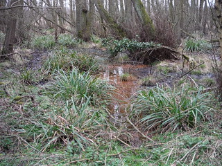
Iron-Rich Stream, Flitwick Moor
SWC Walk 231 Flitwick Circular
Mar-16 • thomasgrabow on Flickr
swcwalks swcwalk231 banner walkicon 26132203325
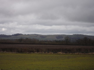
Greensand Ridge from Wardhedges
SWC Walk 231 Flitwick Circular
Mar-16 • thomasgrabow on Flickr
walkicon swcwalks swcwalk231 26066287121

Wrest House and Garden Wall
SWC Walk 231 Flitwick Circular
Mar-16 • thomasgrabow on Flickr
walkicon swcwalks swcwalk231 26066258691

Old St. Mary's Church, Clophill
SWC Walk 231 Flitwick Circular
Mar-16 • thomasgrabow on Flickr
walkicon swcwalks swcwalk231 25529835533
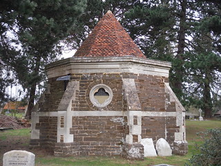
Ailesbury Mausoleum & Crypt, Maulden
SWC Walk 231 Flitwick Circular
Mar-16 • thomasgrabow on Flickr
walkicon swcwalks swcwalk231 25529664313
Flitwick Moor
SWC Walk 231 Flitwick Circular
Mar-16 • thomasgrabow on Flickr
walkicon swcwalks swcwalk231 25859354600
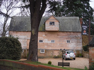
Flitwick Mill House
SWC Walk 231 Flitwick Circular
Mar-16 • thomasgrabow on Flickr
swcwalks swcwalk231 26066326291
| Length | 25.0 km (15.5 mi), with 194m ascent/descent. For a shorter walk see below Walk Options. |
|---|---|
| Toughness | 4 out of 10, with 5 ½ hours walking time. For the whole outing, including trains, sights and meals, allow at least 8 hours. |
| Walk Notes |
This Central Bedfordshire walk just north of the easterly end of the Chilterns initially follows the tranquil Flit River along the shady wooded fringes of Flitwick Moor, one of the most important wetland sites in the south east of England, and then veers away from the river through a couple of quiet villages, en route passing the Grade I-listed De Grey Mausoleum in Flitton and the also Grade I-listed Wrest House and Gardens in Silsoe. This is followed by a longer stretch through rolling fields with views to the Greensand Ridge. After crossing the Flit near Clophill the walk leads up the Greensand Ridge, descending for lunch back into Clophill.
A much shorter walk option, with less ascent as well, and rated 1 out of 10, is described.
|
| Walk Options |
A pre-lunch shortcut cuts 7.2 km (4.4 mi) and 120m of ascent/descent and has a rating of 1/10.
|
| Maps | OS Explorer: 193 (Luton & Stevenage)
OS Landranger: 153 (Bedford & Huntingdon) |
| Travel | Flitwick station, map reference TL 034 349, is 15 km north of Luton, 79m above sea level and in Central Bedfordshire. It is on the Brighton to Bedford-Thameslink line, stopping at East Croydon, London Bridge, Blackfriars, City Thameslink, Farringdon, St. Pancras International and West Hampstead Thameslink. Journey times from St. Pancras to Flitwick (four trains per hour) are from 46 minutes Mon-Sat and from 50 minutes Sundays.
Saturday Walkers’ Club: Take the train closest to 9.30 hours (assuming travel from St. Pancras). |
| Lunch |
Early options in Flitton and Silsoe. For details see page 2 of the Walk Directions pdf.
|
| Tea |
Various options in Maulden (6 km from the end of the walk) and in Flitwick. For details see page 2 of the Walk Directions pdf. |
| Profile | |
|---|---|
| Help Us! |
After the walk, please leave a comment, it really helps. Thanks! You can also upload photos to the SWC Group on Flickr (upload your photos) and videos to Youtube. This walk's tags are: |
| By Train |
Out (not a train station) Back (not a train station) |
| By Car |
Start MK45 1AJ Map Directions |
| Amazon | |
| Help |
National Rail: 03457 48 49 50 • Traveline (bus times): 0871 200 22 33 (12p/min) • TFL (London) : 0343 222 1234 |
| Version |
Apr-24 Thomas G |
| Copyright | © Saturday Walkers Club. All Rights Reserved. No commercial use. No copying. No derivatives. Free with attribution for one time non-commercial use only. www.walkingclub.org.uk/site/license.shtml |

Walk Directions
Full directions for this walk are in a PDF file (link above) which you can print, or download on to a Kindle, tablet, or smartphone.
This is just the introduction. This walk's detailed directions are in a PDF available from wwww.walkingclub.org.uk